


Odee Township Voting District, Meade County, Kansas
About
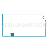
Outline

Summary
| Unique Area Identifier | 585877 |
| Name | Odee Township Voting District |
| County | Meade County |
| State | Kansas |
| Area (square miles) | 95.11 |
| Land Area (square miles) | 94.98 |
| Water Area (square miles) | 0.13 |
| % of Land Area | 99.87 |
| % of Water Area | 0.13 |
| Latitude of the Internal Point | 37.07397540 |
| Longtitude of the Internal Point | -100.37663630 |
Maps


Graphs
Select a template below for downloading or customizing gragh for Odee Township Voting District, Meade County, Kansas


Neighbors
Neighoring Voting District (by Name) Neighboring Voting District on the Map
- Voting District 13, Beaver County, OK
- Voting District 25, Beaver County, OK
- Cimarron Township Voting District, Meade County, KS
- Logan Township Voting District, Meade County, KS
- Meade Center Township Voting District, Meade County, KS
- Sand Creek Township Voting District, Meade County, KS
- West Plains Township Voting District, Meade County, KS
Top 10 Neighboring County Subdivision (by Population) Neighboring County Subdivision on the Map
- North Beaver CCD, Beaver County, OK (2,698)
- Meade Center township, Meade County, KS (2,001)
- West Plains township, Meade County, KS (1,320)
- Logan township, Meade County, KS (87)
- Cimarron township, Meade County, KS (75)
- Sand Creek township, Meade County, KS (38)
- Odee township, Meade County, KS (37)